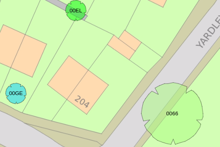
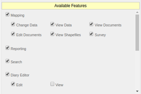
Seamless mapping and aerial photographyFull gazeteer (postcode and map derived)Attachments (photos taken in the field and files, e.g. pdf)Shapefiles, view your own GIS supplied layersFully compatible with Ordnance Survey dataExport your tree stock to ShapefileOS MasterMap, AddressBase, NLPG, Aerial PhotosSend survey queries directly to surveyorsView complete audit of all captured dataMappingOrdnance Survey MasterMap
Setting report criteriaUser defined reportsBespoke reports e.g. Tree Canopy Cover by AreaGraphical Pie Charts and Bar ChartsPrint to pdf, paper or export to xml/ExcelExport to Google SheetsReport by geographical areaReport by selected treesReporting
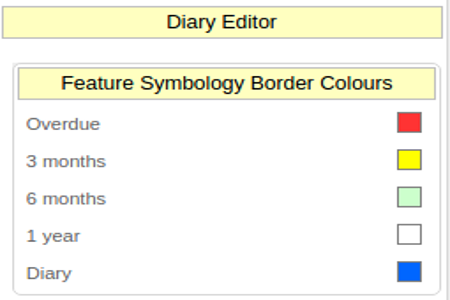
Facility to guide your surveying teamGuidance to next inspections requiredGuidance to ad-hoc tree inspectionsTree colours set automatically for urgent treesTree colours reset once inspectedProvides guidance in the field, inc distance and directionDiary EditorSetting diary symbology
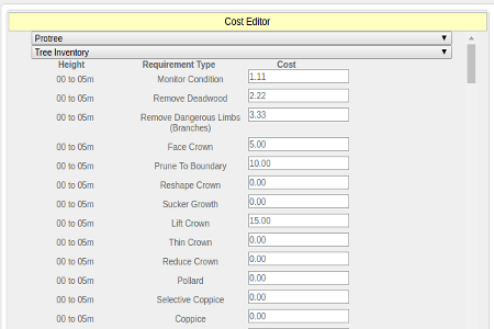
Editing schedule or ratesCreate schedule of rates for each contractorPrices can set by job spec and tree specificationCreate orders by geographical area, street, park, work typeCreate cyclical work ordersGenerate financial reports by contractor and date periodContractors can log in to sign off work / add notesExport work orders to xml/Excel/Google SheetsWork Orders
Edit individual users security and limit controlAmend drop down listsProgram Schedule of RatesEdit contractor detailsUpload and download shapefiles for use in your GISBackup your files and dataControl tablet access remotelyAdministrationEditing users access right